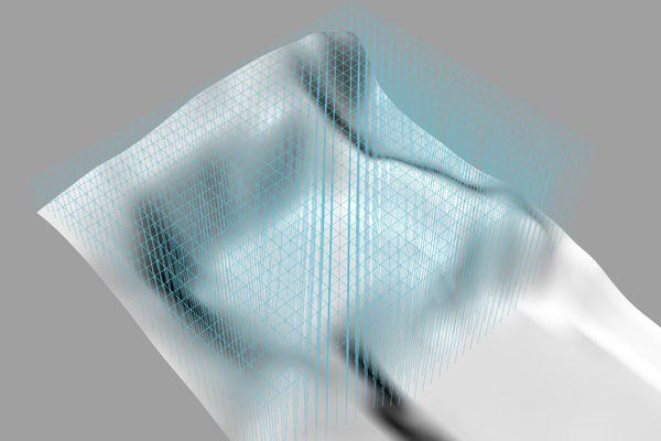
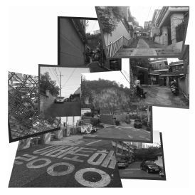
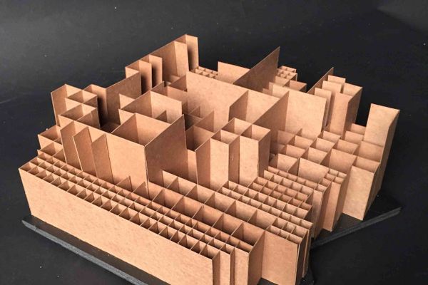
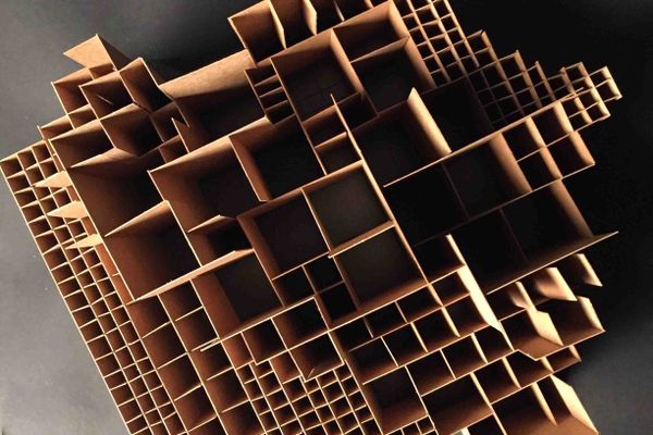
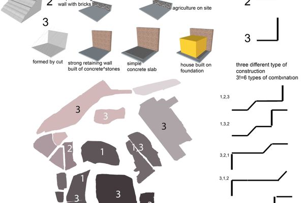
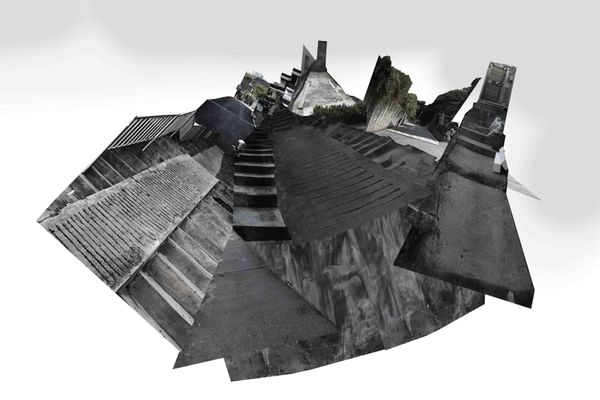
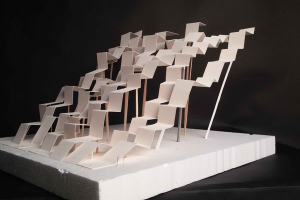
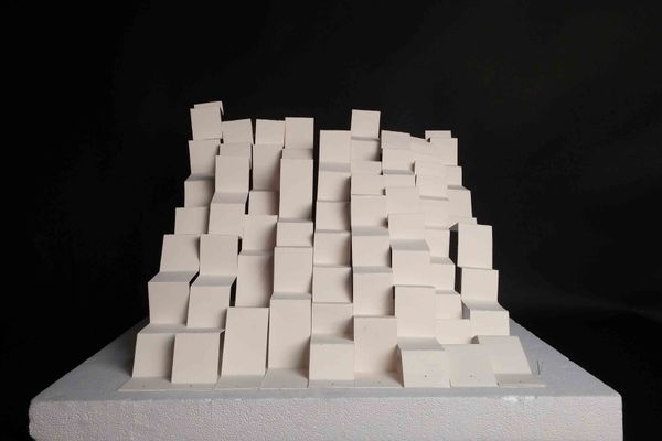
* 과제내용 : The premise of the studio is that the project is site-specific and thus tightly engaged with the study area. In this task, you are asked to develop an understanding of the context of intervention and to take a position as a designer.Students will be provided with a site area in Changsing-dong. They will propose modifications to the site in order to reveal and activate latent spatial opportunities. These modifications / activations do not need to respond to utilitarian, practical, or economic goals but need to challenge the spatial / temporal dimensions of the study area. The site is located on a steep, east facing hillside in Changsin-dong, north of Dongdaemun. The hillside was apparently excavated as an open air stone quarry in the past, thus its particular shape.The area is bound to the east on its lower side by a public parking lot, to the south by a public road and residential areas, to the west on its higher part by a public playground and public facilities and to the north by residential development. The main current use of the area is a public recycling facility. Students can decide to keep the facility and interact with it with their designs, or remove it completely.Site area is 13,728m2 and there is an approximated drop of 80m west-east.* 포스트내용 :A DIGITAL COLLAGE that re-presents the study area from a particular point of view of your choice. You are not supposed to describe the study area, but to reinterpretit, using the collage technique that allows you to show and hide aspects of the reality, thus accentuating spaces, directions, tensions, patterns, etc. The goal of the collage is to reveal formal patterns latent in the study area. These patterns may be the result of historical, geological, economic or planning processes, but we will focus only on their physical/spatial/formal outcomes.MAP: An interpretation of the study area in ways that predispose your intervention in it.For the purpose of the studio, we will understand mapping as an agency aimed to recreate / reshape reality (rather than to simply describe it), in order to reveal hidden potentials. Thus, a map is intentionally subjective and performative rather than objective; and it is intrinsically analogous (since it records reality) as well as it is abstract (as it also edits this reality, either by isolation, omission, isolation or other types of codification). Mapping is thus not a description of reality, but the purposeful, operative and strategical re-configuration of this reality in order to delineate opportunities for intervention. It is not descriptive (use of adjectives), but performative (use of verbs). Mapping is not only a way to see the world but a way to construct it. It departs from what is there in order to suggest what could or should be there. The goal of mapping is to re-interprete the study area from the point of view of the formal patterns discovered in the previous collage exercise. Identify and express the formal rules governing those patterns. How are they deployed in the study area? What are their opportunities? Your maps should propose a formal understanding of the study area based on the geometrical rules behind the patterns you have found.SPATIAL PROBE. Departing from your 2D mappings of the study area, propose a 3D adaptation of the patterns you have found on the site. The outcome should not be understood as a "building", but rather as a formal strategy that pre-sets a way to intervene on the site. The definition of boundaries and thresholds interfacing with the context will be stressed.* 과제 제출 요령오픈아카이브 메뉴얼 바로가기* 과제제출 주의사항 대표 이미지:!! 내용: 잘 찍은 사진, 과제의 대표성 강조 가시성: 300px X 300px 크기에서 잘 읽히는 내용을 담을 것. 용량: 1mb 이하. * 각 이미지는 용량 2M 이하
프로젝트 2
SITE CONSTRUCTION
SITE CONSTRUCTION
Copyright © uosarch.ac.kr., Some rights reserved.